No hike is to be undermined just for the fact that one does not know what challenges lay ahead and how the body reacts to them over the distance. And here we were, the three of us, James Cross, Neil Guertin and myself planning hard for a grueling day in the White Mountains. We were excited, yet keeping an eye out for the weather given the historical data of the area.
Drive to Gorham NH
James cross was the most experienced among us and hence led the way by putting together a plan and making sure we had all the gear we needed to survive the course of the day. It was about 4 pm on Friday (11/04/2016), when we started our journey in two cars towards New Hampshire. The drive was as expected, with stop-go traffic in certain routes. We had dinner, parked my car in the lot where we were to complete our hike, and checked into the motel where James had booked accommodation for the night. After a short review of our hike routes/plans we went to bed for the shortest time I have probably slept (10 pm to 2:50 AM).
The Hike
Ascent to Mount Washington
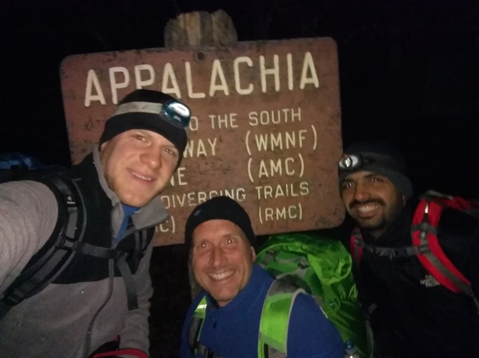
With multiple clothing layers on our bodies, we set out to the Appalachia trail head. It was the first time in my life that I had 3 layers each to cover the upper and lower parts of my body. Felt too much, turned out a wise decision. The gear we had included ski goggles, full face masks, trekking poles, micro spikes, head lamps and weatherproof clothing. Nothing else will give you a better estimate of what we were expecting the weather to be. It was 3:40 AM on Saturday (11/5/2016) by the time we started our ascent to the first peak in the presidential range, Mount Madison via the Valley Way trail. The car did it’s job taking us to the trail head, it was time for our bodies to do theirs.
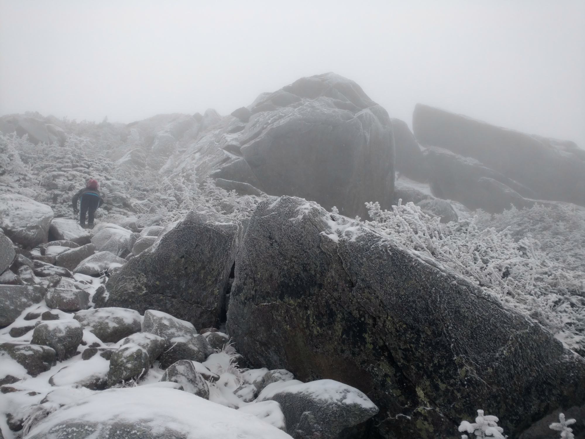
Just like every other physical activity, the body takes time to get into the rhythm. I was feeling it, predictably, as the last hike I completed was months ago. Nevertheless, with timely breaks we started making progress with a steady pace. With more snow and icy rocks in sight, it was time for the micro spikes. We started to go above the tree line and into exposed territory. At the summit of Mount Madison, Neil turned out to be the luckiest of the three, as he saw the sunrise through the clear sky which lasted for seconds. What was to follow, was an undulating hike until the end. We incrementally gained vertical until Mount Washington and then steadily went down as the image below justifies.

Source: TrailToSummit (disregard the date on the top right, mountains don’t grow!)
We started our longest exposed stretch from the summit of Mount Madison. Soon, we were at the summit of Mount Adams. ‘Soon’ here is with reference to our initial climb. You realize how much a mile is, when you do activities like these. Here’s where things got pretty fuzzy. There are generally two aids to finding a trail, either you get a sign board or you follow the cairns. With snow capped cairns, it’s hard to differentiate a bush from a cairn. We started the descent from Adams to Jefferson only to find out that we lost the trial. James pulled out his compass and we had to take a detour to join the right trail. Ended up being an hour’s extra effort. With some energy bars and water to refuel ourselves we reached the summit of Mount Jefferson, which happened to not have a sign board indicating so (trust me that is disheartening).
We had already decided to skip Mount Clay (not named after a president) and hence the daunting Mount Washington was our next challenge. In the undulating pattern, the ascent to the summit succeeding the descent is the hardest on the legs. The 1 mile climb to Washington took a hug toll on us. It felt relentless, unforgiving. The downside of hiking in winter is not having the peak in peak. It deprives you of that surge to the summit. We lost the trail again, but luckily found the cog rail track. I was running on empty by this time. My mind was resonating ‘Did you really want to do this? I think you underestimated what it takes to complete this’.

Believe it or not, the thought of lunch (refueling opportunity) at the summit coupled with the fact that the following peaks were to be conquered on the way down, boosted my spirits and dragged me up. We made it to the summit! Lunch break! We had stopped just 200 feet before the summit and we couldn’t see the buildings. That was the amount of visibility we had, zero. We were optimistic of finding a place which would shield us from the wind (speed in excess of 50 mph). Just as we lost all hope of finding one, a group of folks who were about to leave from the summit, showed us a relatively favorable spot. Two walls which gave us decent protection. As we prepared to eat lunch, the outer clothing layers we had were all frozen solid. Lunch was never so fulfilling.
Descent to my car
After a refuel, we were all set for our second leg of the journey. The descent to the Lake of the Clouds Hut was harsh. The icy wind was in our faces making us clean our goggles every minute to see clearly. Given the already poor visibility, this was a necessity. The progress was considerably slower after our initial ascent due to the harsh conditions. It was around 4 pm or so when we reached the hut. We had to choose our battles, considering the fact that the light was soon fading. Our aim was to get down into the tree line before the lose natural light. We had the energy, now it was a question of endurance. It took us to the summit of Mount Monroe where the weather became colder with the fading light. With the head lamps back on, we set our sights on the Crawford path trial which was to lead us to the end with small ascents to reach the summits of Mount Eisenhower and Mount Pierce. Keeping the time of day in mind, we skipped the summit of Eisenhower and headed towards Mount Pierce. My mind was already picturing me in the car and hence I decided to stay at the junction and let James and Neil go to the summit of Pierce.
They were back and all that was left was the 3 mile downhill stretch to the parking lot, where my car was waiting to pick it’s adventurous to-be passengers. If ever there was time when I felt that the destination is far, it was this. As Cindy Ross has said, “Returning home is the most difficult part of long-distance hiking; You have grown outside the puzzle and your piece no longer fits.” My legs started to feel the weight, knees under pressure, the bag a burden. Amidst all this, we got a string of conversations going which helped divert the mind. At 8:45 pm we saw the license plate of my car in the parking lot and just let all our gear go. It felt weird to be on flat ground (that was true for two more days after the hike). The relief was clear on our faces, but the sense of an achievement, even more so. We came through unscathed, in one piece. The only casualties were the two trekking poles I borrowed from James, the lower connectors were broken. That is good news given the conditions we were hiking in.
If you were describe our adventure statistically, we hiked about 21 miles in 17 hours (~12 above the tree line) with a vertical gain of about 9000 feet, making six of the seven summits we targeted. Pretty satisfying, now that I look back. Oh, not to forget the average numbers for temperature and wind speed on the day were -7 deg C and 47 mph respectively. All in all, it was a wild experience, with no room for errors and complacency. It was a test of strength, grit and endurance that we passed. Things like this deserve a write up. After all, you never know if you will find a better adventure ever again.

“A crude meal, no doubt, but the best of all sauces is hunger.” – Edward Abbey on hiking.

Fantastic achievement my son. It must have been an demanding adventurous hike.
Congratulations to all three of you
Vinod khadilkar
LikeLiked by 1 person
These kind of breathtaking adventures need detailed description rather than just handful of photos!!
Worth reading..
LikeLiked by 1 person
Fantastic…
Beautifully narrated…
Mast le
LikeLiked by 1 person
That’s a great memorable experience! I wish you gather many more in the coming years 🙂
LikeLiked by 1 person
Nice writeup Nakul…looks like it was fun…
LikeLiked by 1 person